
Page 70 - :: สมุดภาพกรมทางหลวง เล่ม ๒ ::
P. 70
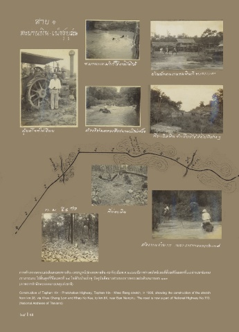
การสร้างทางหลวงแผ่นดินสายตะพานหิน - เพชรบูรณ์ (ช่วงตะพานหิน - เขารัง) เมื่อ พ.ศ. ๒๔๗๙ มีภาพร่างสเก็ตช์แผนที่ตั้งแต่กิโลเมตรที่ ๓๘ ผ่านเขาช่องลม
เขาเกาะแกะ ไปสิ้นสุดที่กิโลเมตรที่ ๖๔ ใกล้กับบ้านน�้าพุ ปจจุบันคือบางส่วนของทางหลวงแผ่นดินหมายเลข ๑๑๓
(ภาพจากส�านักหอจดหมายเหตุแห่งชาติ)
Construction of Taphan Hin - Phetchabun Highway, Taphan Hin - Khao Rang stretch, in 1936, showing the construction of the stretch
from km.38, via Khao Chong Lom and Khao Ko Kae, to km.64, near Ban Namphu. The road is now a part of National Highway No.113.
(National Archives of Thailand)
68 I 68