
Page 43 - สมุดภาพ กรมทางหลวง ยุคแรก เนื่องในโอกาส ๑๐๙ ปี กรมทางหลวง ๒๔๕๕-๒๕๖๔
P. 43
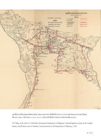
แผนที่ประเทศไทยแสดงเครือข่ายเส้นทางของกรมทางหลวงในพื้นที่ภาคกลาง (รวมภาคตะวันออกและภาคตะวันตก)

               เมื่อ พ.ศ. ๒๕๐๐ อัตราส่วน ๑ : ๒,๐๐๐,๐๐๐ (ภาพจากหนังสือประกาศกรมทางหลวงแผ่นดิน ๒๔๙๙)


               1957 Map, at the scale of 1:2,000,000, showing the Department of Highways’ national highway system in the Central,
               Eastern, and Western parts of Thailand. (Announcements of the Department of Highways, 1956)


                                                                                                       41 I 41